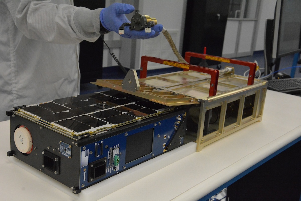
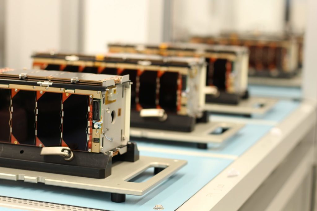
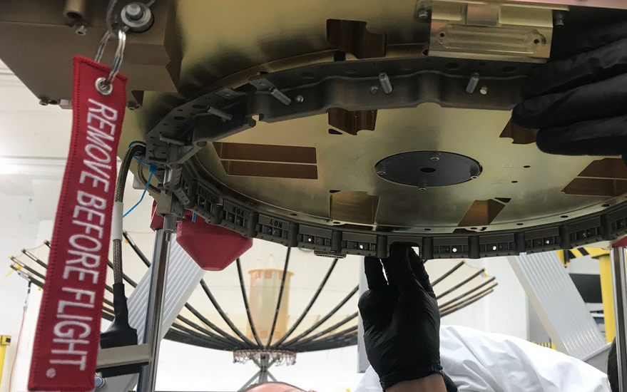
CICERO (Community Initiative for Cellular Earth Remote Observation) is a constellation of 24+ satellites for radio occultation measurements of Earth’s atmosphere and surface remote sensing through backscattered signals from the GPS and Galileo satellite constellations. The system is operated by GeoOptics Inc. and Tyvak Nano-Satellite Systems Inc. acts as the primary contractor for the 6 Unit CubeSats. CICERO satellites host CION instruments (CICERO Instrument for GNSS-RO) which perform GNSS-RO by sensing radio signals broadcast by GNSS satellites (GPS and Galileo) and measuring the phase delay due to refraction during occultation. Second-generation CICERO-2 satellites (two launched in 2022) carry an improved CION instrument, CION-2, which measures reflected signals from the sea surface and has a polarimetric capability, in addition to GNSS-RO. CION and CION-2 data produce high-accuracy profiles of atmospheric pressure, temperature, and moisture; 3D maps of the electron distribution in the ionosphere; and information on ocean and ice properties. The CICERO-2 satellite constellation are improved versions of the 1st generation CICERO satellites. GeoOptics creates the highest quality radio occultation (RO) weather data available today. The data is available for government, commercial, and research purposes. GeoOptics also develops new instruments to observe the Earth’s atmosphere, surface and subsurface. Founded and led by a team of scientists and engineers, the company focuses on finding answers to some of the most important questions facing the globe.

Satellite info

Nation: USA/Monaco
Company/operator: GeoOptics
Platform/configuration: 6U CubeSat
Mass: 10 kg
Orbit: 520 km - Low Earth Orbit (LEO)
Instruments:
  • Cion GPS radio occultation payload
Purpose: Demonstration of GPS radio occultation sensor that allows the measurement of global weather pattern with high accuracy.
Launch vehicles: Soyuz-2, PSLV-XL, Electron, Vega
Website: https://geooptics.com

GeoOptics

Capella Space was founded in 2016 and is a American space company, specialized in space-based radar Earth observation satellites equipped with synthetic-aperture radar (SAR). Synthetic-aperture radar (SAR) is a form of radar that is used to create two-dimensional images or three-dimensional reconstructions of objects, such as landscapes. Unlike optical technology, synthetic aperture radar (SAR) can “see” through darkness, clouds, and rain, detecting changes in habitat, levels of water and moisture, effects of natural or human disturbance, and changes in the Earth's surface after events such as earthquakes or sinkhole openings. Capella Space's SAR satellites deliver global insights into commerce, conservation, and security on Earth. Capella Space plans to deploy a fleet of small radar satellites to provide regularly-updated imagery to the U.S. government and commercial customers. In 2018 and 2020, Capella Space's first satellites were launched into space after which the company began rolling out the Whitney network of satellites. In 2023, Capella Space started to develop a new generation of satellites called 'Acadia'. These new satellites represent an improvement from the previous Capella ones with increased radar bandwidth from 500 MHz to 700 MHz, and will be able to provide better resolution, higher imaging quality and shorter times between customer orders and delivery. Acadia satellites will also be equipped with optical communication terminals (OCTs) making Capella Space the first commercial SAR company to demonstrate Optical Inter-Satellite Links. Each Capella satellite has a three-year design life. By launching 12 satellites per year, the constellation will maintain its imaging capability indefinitely.

Satellite info

Nation: USA
Company/operator: Capella Space
Platform/configuration: Capella-platform
Mass: 110 - 195 kg
Orbit: 225 km - Low Earth Orbit (LEO)
Instruments:
  • X-band SAR
Purpose: Commercial SAR imagery, radar Earth observation
Launch vehicles: Electron, Falcon 9
Website: https://www.capellaspace.com

Unseenlabs

Video

Unseenlabs is the world leader radio frequency (RF) data and solutions provider for Maritime Domain Awareness. Its unique technology allows the geolocation and characterization of any vessel at sea, at any time of the day or night, anywhere on the globe, and in any weather conditions. Unseenlabs provides its customers with high added value data and solutions to fight against illegal activities at sea. The ability to locate and monitor vessels is essential in the fight against pollution and illegal traffic and contributes to the safety on our oceans. The French start-up company was founded in June 2015 by Clement and Jonathan Galic and joined forces in 2017 with GomSpace ApS of Denmark to co-engineer and supply its first satellite platforms, in the CubeSat 6U6 format. The first Unseenlab nanosatellite was launched in 2019 and was the first step towards a constellation of satellites using advanced spectrum monitoring dedicated to a disruptive maritime surveillance service. Unseenlabs plans to deploy a constellation of 25 BRO (Breizh Reconnaissance Orbiter) nanosatellites by 2025. Most of these satellites are launched by Falcon 9 rockets of SpaceX. Unseenlabs is located in Rennes, France.

Satellite info

Nation: France
Company/operator: Unseenlabs
Platform/configuration: 6U CubeSat
Mass: 6 kg
Orbit: 400 km - 650 km Low Earth Orbit (LEO)
Instruments:
  • RF-technology
Purpose: Maritime traffic, electromagnetic intelligence service, spectrum monitoring service
Launch vehicles: Electron, Vega, Falcon 9
Website: https://unseenlabs.space

Unseenlabs

Video

Founded in 2014, Astrocast is a leading global nanosatellite IoT network operator that offers a Cost-effective, Bidirectional and Comprehensive Satellite IoT Service to tackle global connectivity challenges in remote areas for industries such as Maritime, Agriculture & Livestock, Environmental & Utilities, Land Transport, Mining, Oil & Gas, and other IoT industrial applications. The Astrocast network enables companies to monitor, track, and communicate with remote assets from anywhere in the world, and is the only New Space IoT LEO network with commercial access to L-band through a strategic alliance with Thuraya. In partnership with Airbus, CEA/LETI and ESA, Astrocast developed the Astronode S, an ultra-low power and miniaturised module compatible with inexpensive L-band patch antennas. Astrocast is a public company listed on Euronext Growth Oslo. Working towards deploying our full constellation by 2025, the Astrocast Satellite IoT Service offers a Cost-effective, Bidirectional, and Comprehensive service to tackle global IoT connectivity challenges in remote areas of the world. The 100-nanosatellite constellation spanning the globe and allowing for low latency transmission. In addition, the satellites are equipped with propulsion and deorbiting, allowing greater control of the entire network and the ability to avoid unlikely collisions with space debris.

Astrocast satellites info

Nation: Switzerland
Company/operator: Astrocast SA
Platform/configuration: 3U CubeSat
Mass: 5 kg
Dimensions: 10 x 10 x 37 cm
Orbit: 515 km x 535 km
Inclination: 97,4 degrees (polar orbit)
Instruments:
  • L-band communications
Purpose: Communications/IoT/machine-to-machine services
Launch vehicles:
  • Falcon 9
  • PSLV
Website: https://www.astrocast.com

Astrocast

Video

Umbra is a California based startup founded in 2015 by David Langan and Gabe Dominocielo. Umbra’s micro-satellites are equipped with a powerful Synthetic Aperture Radar (SAR) payload, capable of seeing both day and night and through dense clouds to generate the highest-resolution radar images ever sold on the commercial market. The first satellite, Umbra-SAR 2001, was launched in June, 2021 and was designed to capture snapshot imagery with a resolution of 25 centimeters over a 16 square km area. In January 2022 Umbra was selected by the National Reconnaissance Office (NRO) for the first Focus Area, Commercial Radar, under the agency’s new Broad Agency Announcement (BAA) for Strategic Commercial Enhancements effort. The NRO selected also other commercial radar imagery providers, like Capella Space and ICEYE. In October, 2022 DARPA selected Umbra to join the Distributed Radar Image Formation Technology (DRIFT) Program. The program uses commercially developed satellites to support government goals with a focus on formation flying and joint collection from small SAR satellites to collect synchronized monostatic and bistatic data.

Umbra-SAR satellites info

Nation: USA
Company/operator: Umbra
Platform/configuration: Umbra-SAR
Mass:
  • 65 kg (Umbra-SAR 2001)
Orbit:
  • 522 km - 535 km (Umbra-SAR 2001)
Inclination: 97,4 degrees (polar orbit)
Instruments:
  • X-band SAR
Antenna size: 11,3 m²
Purpose: Earth monitoring
Launch vehicles:
  • Falcon 9
Website: https://umbra.space

Umbra-SAR

Video

More Articles …